DILRMP 3.0 Guidelines Launched to Modernise India’s Land Records
Central Sector Scheme approved with an outlay of ₹565.50 Crore for 2026–2031 to establish an integrated, GIS-based ‘Land Stack’


 The Impressive Times
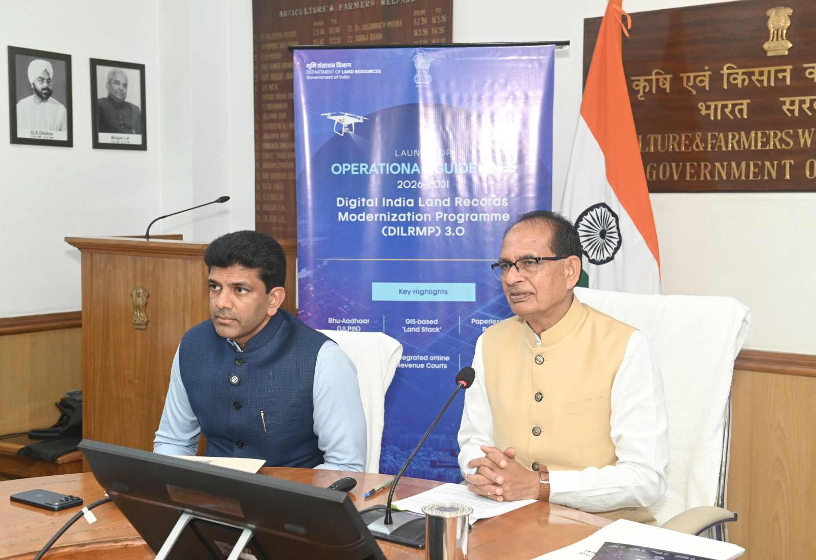
New Delhi, September 10, 2026: Union Rural Development Minister Shivraj Singh Chouhan has launched the operational guidelines for Digital India Land Records Modernisation Programme (DILRMP) 3.0, marking a fresh push to integrate land records, registration systems and mapping technologies across the country.
The new phase has been approved as a Central Sector Scheme with an allocation of ₹565.50 crore for 2026–2031. The programme aims to create an integrated, GIS-based digital framework for land administration and make property-related government services more accessible to citizens.
Speaking at the launch event at Krishi Bhawan, Chouhan said that land has a deep social and emotional significance for Indian families and farmers. He stressed the importance of maintaining reliable records and ensuring that citizens can access land-related services without repeated visits to government offices.
_20260910220350_fed12a.jpeg)
A major component of the programme is the proposed GIS-enabled Land Stack, which will connect multiple datasets, including cadastral maps, Records of Rights, property registrations and relevant court information.
States will be able to integrate their existing land-related systems through APIs to create State-level Land Stacks. These will eventually contribute to a federated National Land Stack, while data ownership remains with the respective authorities.
Under DILRMP 3.0, every land parcel will receive a unique 14-digit Bhu-Aadhaar, also known as ULPIN.
The identification system is intended to establish a distinct digital identity for land parcels, improve record accuracy and reduce the possibility of property-related fraud and disputes.
The government said earlier phases of DILRMP had already digitised 99.90% of Records of Rights and 97% of cadastral maps, while computerisation has covered 99% of Sub-Registrar Offices.
_20260910220440_985bc4.jpeg)
The programme also proposes the transformation of 75 high-footfall Sub-Registrar Offices into modern Registration Seva Kendras.
These centres will feature improved citizen facilities and digital queue-management systems, with the model drawing inspiration from Passport Seva Kendras.
The initiative is aimed at making property registration more organised and user-friendly.
DILRMP 3.0 will also focus on scanning and digitally preserving historical land and property registration documents.
The move is expected to strengthen the preservation of inheritance records and help address disputes involving ancestral properties.
A dedicated Registration Repository will provide a secure digital system containing registered deeds and encumbrance-related information. It will support ownership verification, transaction-history checks and property due diligence.
Another important reform is the proposed integration of the Revenue Court Case Management System (RCCMS) with land records.
The linkage is intended to improve case management, reduce delays and speed up mutation-related settlements by allowing courts and land-record systems to exchange relevant information.
The government will also accelerate the NAKSHA pilot project, which focuses on developing accurate GIS-based records for urban land.
The initiative will support the preparation of digital urban land records and the issuance of Urban Property Cards, helping establish clearer property information in urban areas.
DILRMP 3.0 will be rolled out across States and Union Territories with 100% central funding. Implementation will follow a phased and performance-linked approach through the Public Financial Management System.
Progress will be tracked through an upgraded DILRMP-MIS dashboard, with monitoring undertaken by the Project Sanctioning and Monitoring Committee.
Minister of State for Rural Development Dr. Chandra Sekhar Pemmasani said the new phase would address longstanding issues related to spatial accuracy, georeferencing and coordination between different land administration systems.
The launch marks a shift from simply digitising individual land records towards building an interconnected digital infrastructure for land governance.








































No Comments: